What is Lidar Range and How It Transforms Mapping with 99 Accuracy in Topographic Surveys
In the rapidly evolving field of topographic surveys, Lidar Range technology has emerged as a game changer, offering unprecedented accuracy and efficiency in mapping. As experts continue to explore its capabilities, Dr. Emily Thompson, a leading authority in remote sensing technology, aptly noted, "Lidar Range not only enhances the precision of topographic surveys but also opens new avenues for analysis and application that were previously unimaginable."
This transformative technology employs laser pulse measurements to create detailed three-dimensional representations of the Earth's surface, significantly reducing errors that may have plagued traditional surveying methods. The ability to capture vast amounts of data quickly and accurately has not only streamlined workflows but also ensured that the results are reliable, with accuracy rates reportedly reaching 99%.
As we dive deeper into the intricacies of Lidar Range and its profound impact on mapping techniques, it is essential to understand how this innovation is reshaping the landscape of topographic surveys and contributing to more informed decision-making in various industries. The future of mapping is not just about capturing landscapes; it's about harnessing data with precision and insight, paving the way for advancements in environmental monitoring, urban planning, and beyond.
Understanding Lidar Technology: Revolutionizing Topographic Mapping
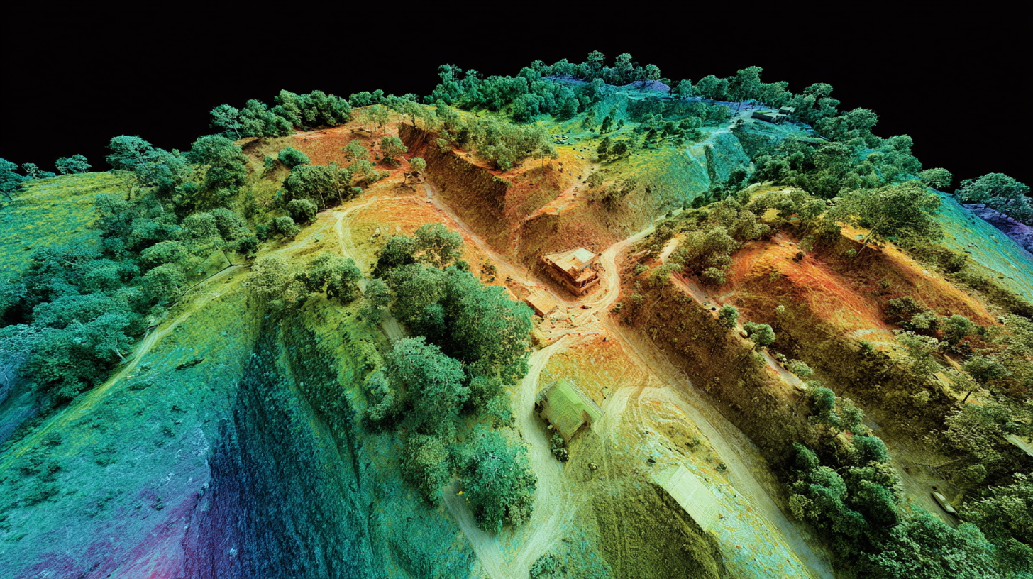
Lidar technology has significantly revolutionized the field of topographic mapping, offering unparalleled accuracy and detail in capturing the Earth's surface. This laser-based remote sensing method emits rapid pulses of laser light to measure distances, which allows for the creation of precise three-dimensional representations of terrain. According to the National Oceanic and Atmospheric Administration (NOAA), Lidar can achieve vertical accuracies of up to 15 centimeters in natural terrain, a stark improvement over traditional surveying methods that typically yield accuracies of about 30 centimeters.
Furthermore, Lidar enhances the efficiency of topographic surveys, enabling vast areas to be mapped in a fraction of the time it would take using conventional techniques. The U.S. Geological Survey (USGS) reports that Lidar can collect data at a rate of up to 1 million points per second, which allows for comprehensive analysis of landscapes, including vegetation structure and hydrological features. This not only facilitates better planning and management in fields such as environmental conservation and urban development but also provides critical data for disaster response and management initiatives, ultimately transforming how we understand and interact with our topography.
Lidar Range and Its Impact on Topographic Surveys
This bar chart illustrates the range capabilities of Lidar technology in various environments, showcasing its effectiveness for accurate topographic mapping.
Key Advantages of Lidar Range in Survey Accuracy and Efficiency
LiDAR technology has emerged as a game-changer in topographic surveys, significantly enhancing accuracy and efficiency in mapping endeavors. One of the key advantages of LiDAR range is its ability to deliver precise data collection over vast areas, which is crucial for sectors like coastal surveying and environmental monitoring. With advancements in LiDAR systems, stakeholders can expect measurable efficiency gains and superior quality data, leading to more informed decisions.
Recent developments in LiDAR technology have focused on improving accuracy and versatility. New systems boast enhanced features such as long-range capabilities and advanced imaging, allowing for better data acquisition even in challenging environments. As these innovations continue to unfold, the benefits of LiDAR in surveying applications become increasingly apparent, offering unprecedented accuracy levels that can reach up to 99%. This transformation not only streamlines the mapping process but also reduces time and resources needed for surveys, establishing LiDAR as an indispensable tool for modern surveying practices.
What is Lidar Range and How It Transforms Mapping with 99 Accuracy in Topographic Surveys - Key Advantages of Lidar Range in Survey Accuracy and Efficiency
| Dimension |
Description |
Value |
| Accuracy |
Level of precision in measurements |
99% |
| Range |
Maximum distance Lidar can measure |
200 meters |
| Data Collection Speed |
Rate of data acquisition per second |
1,000,000 points/sec |
| Survey Time Reduction |
Time saved compared to traditional methods |
Up to 50% |
| Point Density |
Amount of points collected per square meter |
10-50 points/m² |
Applications of Lidar in Various Industries: From Forestry to Urban Planning
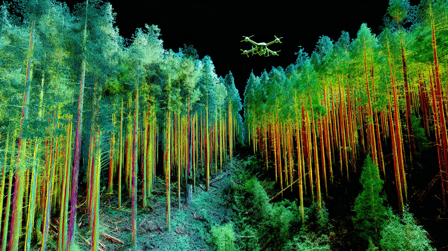
Lidar technology has revolutionized various industries by providing accurate and efficient mapping solutions. In forestry, Lidar is employed to assess tree height, density, and biomass, enabling forestry managers to make informed decisions about resource management and conservation efforts. The ability to create detailed 3D models of forest structures helps in understanding biodiversity and planning sustainable harvesting practices.
In urban planning, Lidar data plays a crucial role in the design and development of cities. Planners utilize this technology to gather precise information on landforms, vegetation, and existing infrastructures. The high-resolution data allows for better analysis of potential developmental impacts and enhances decision-making in zoning and land-use policies. Furthermore, emergency management and disaster response teams leverage Lidar to create flood risk maps and assess geographical changes after natural calamities, ensuring a proactive approach to environmental challenges.
Challenges and Limitations of Lidar Technology in Topographic Surveys
LiDAR technology has made significant strides in the realm of topographic surveys, yet it faces several challenges and limitations that are crucial for industry professionals to be aware of. One of the primary challenges is the high initial cost of LiDAR equipment, which can be a barrier for smaller firms or those new to the technology. Moreover, data processing and interpretation require specialized expertise, which adds additional layers of complexity to project timelines and budgets.
Another limitation lies in the technology’s dependency on weather conditions; fog, heavy rain, or insufficient light can severely impact the quality and accuracy of data collection. Furthermore, while LiDAR excels in capturing surface features, it struggles with dense vegetation, often leading to inaccuracies in representing subsurface details.
Tips: To mitigate these challenges, consider investing in training for staff to improve data processing skills. Regular maintenance and calibration of LiDAR equipment can also enhance data quality. Additionally, employing complementary technologies, such as imagery or ground-based surveys, can provide a fuller picture of the surveyed area and improve overall accuracy.

Future Trends: Innovations in Lidar Technology and Mapping Solutions
The rapid advancements in Lidar technology are shaping the future of mapping solutions, driving innovations across multiple sectors. With the ability to capture highly accurate and detailed topographic data, Lidar systems are becoming pivotal in applications such as urban planning, environmental monitoring, and autonomous vehicle navigation. Recent trends indicate a surge in the use of drone-integrated Lidar systems, allowing for efficient and accessible aerial surveys.
Tips: When considering Lidar implementation for your business, focus on integrating data analytics tools that can interpret the vast amounts of information collected. This will help you derive actionable insights and enhance decision-making. Additionally, stay informed about the latest startups in the field, as many are pioneering novel approaches to Lidar technology that could offer competitive advantages.
Emerging innovations also include the integration of artificial intelligence in Lidar data processing, which streamlines operations and improves accuracy. As companies increasingly adopt Lidar technology, businesses can harness these trends to improve their operations, reduce costs, and gain a strategic edge in their respective markets. Explore partnerships with Lidar-focused startups to stay ahead in this dynamic landscape.